Flood forecasting in Kazakhstan
A free flood forecasting system based on satellite data.
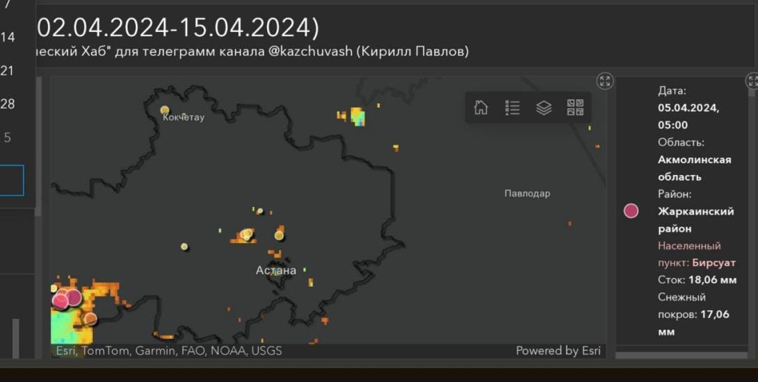
Flood risk and forecasting map for all regions of Kazakhstan.
Quick guide:
1. On the left, there are sliders. To view the equivalent water runoff from snowmelt, move the slider to a value of 70 mm. Set the snow cover slider to zero. (If you need to view snow cover, do the opposite).
2. Select the desired date on the calendar. The map will show districts and settlements located in the flood hazard zone for that period. The size and color of the dots indicate the risk level — the larger and darker the dot, the higher the flood risk.
The forecast is available until mid-April 2024.
Comments ()