Threat of dam breach around the Sorbulak reservoir near Almaty
A lake could wash away several downstream settlements. Over 50,000 people are in the potential flood zone.
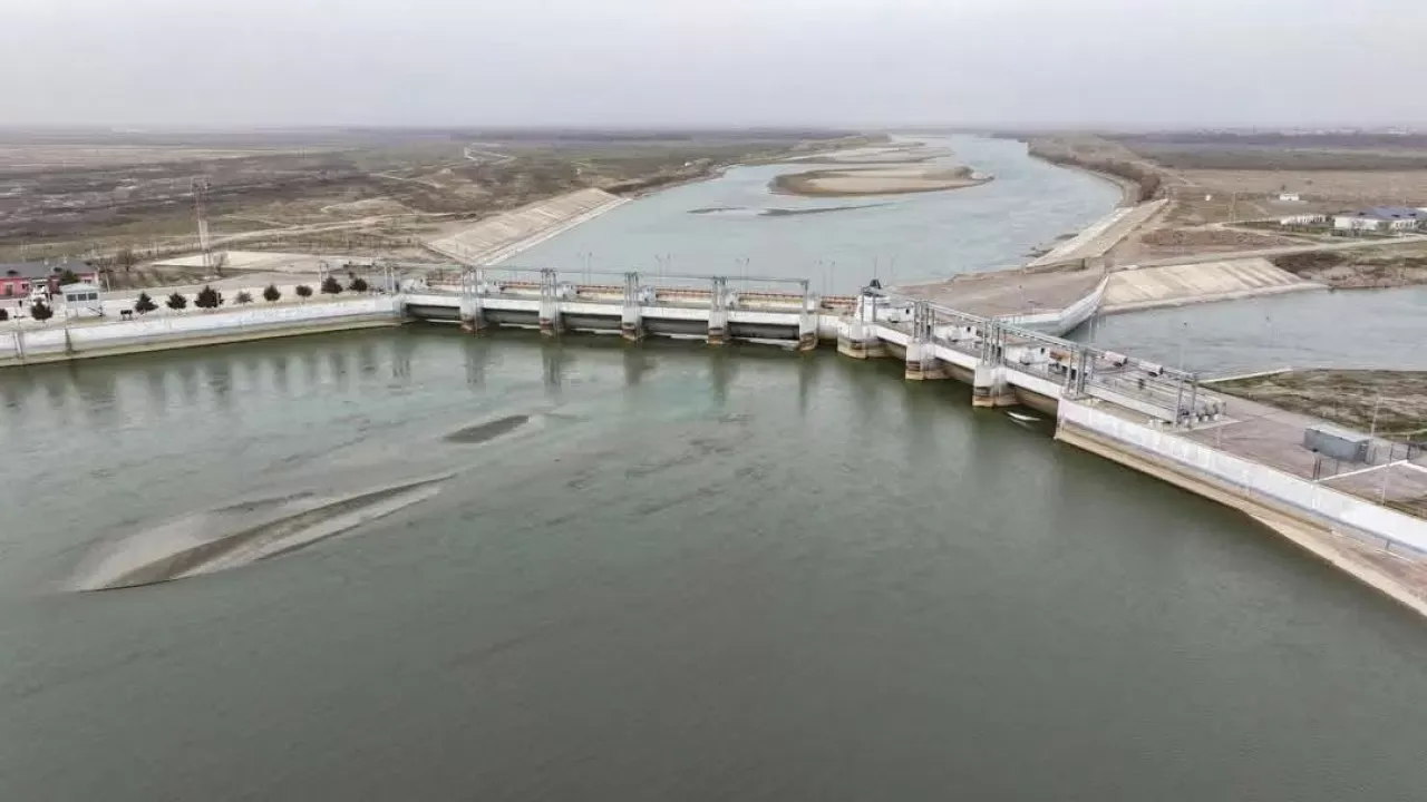
Due to the illegal narrowing of the riverbed, a river near Almaty overflowed its banks.
Meanwhile, the risk of a breach of the Sorbulak reservoir, where Almaty discharges its wastewater, is increasing. That such a problem was brewing was written by Misha Kozachkov back in 2013:
“Based on the results of the research work, it was concluded that the lake could wash away several settlements located downstream. The potential flood zone includes over 50,000 people.”
Over 12 years, the situation has only worsened and the risks have increased significantly.
I am reading a document titled “COMPREHENSIVE STUDY OF LOW-HEAD EARTH DAMS OF THE SORBULAK WASTEWATER RESERVOIR.” In the study, the authors R.R. Iskanderov and Zh.T. Tleuova (U.M. Akhmedsafin Institute of Geological Sciences) see the problem but draw incorrect conclusions. More precisely, they see the flaws but do not consider them a problem.
Therefore, here is an analysis and assessment of the condition of dams No. 1 and No. 2 of the Sorbulak reservoir based on satellite observations and engineering materials:
1. Brief Description of the Facility
- The dams are made of sandy loam and clay loam soils.
- Dam height — up to 6 m; capital class — IV.
- According to the design: filtration — minimal, foundation stable, no signs of failure.
2. Results of Satellite Analysis
Based on the analysis of visual and spectral images, the following signs were identified:
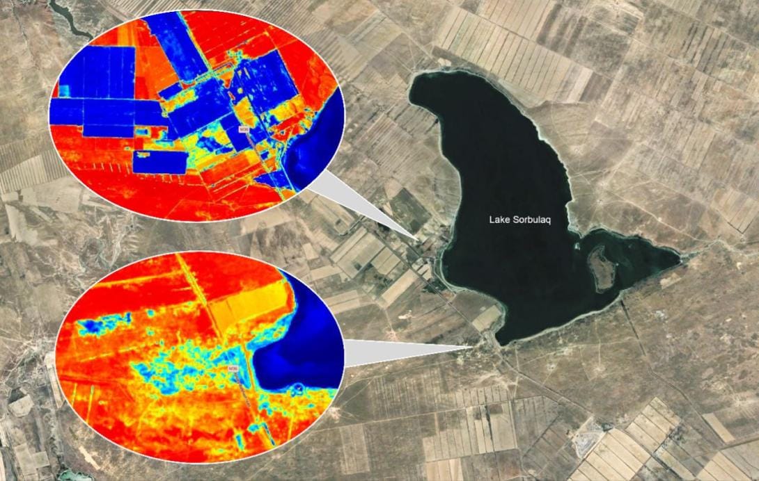
- A wide zone of waterlogging behind the dam — clearly distinguishable in the soil moisture range (IR/SWIR), indicating intense water filtration through the dam body or foundation.
- Possible salt and suffosion deposits — observed on visual images as discolored areas.
- Disturbance of vegetation structure in the filtration zone — indicates chronic moisture impact.
Fig. 1. Visual satellite image of the dam and filtration zone.

Fig. 2. Moisture index image (Sentinel-2, 07/23/2024), showing waterlogging behind the dam.
3. Contradiction with the Official Conclusion
The official report states:
- Filtration — within normal limits;
- Suffosion and soil erosion are absent;
- The foundation and dam body are in a stable condition.
However:
- Remote sensing data indicate active filtration. - Soil erosion and saturation of subsiding layers (IGE-I) are possible.
- Increased humidity in the downstream area may be an underestimated threat of suffosion or piping.
4. Conclusions
- Objective signs of filtration development have been recorded, contradicting the official conclusions.
- The soil composition (sandy loam, presence of salts and subsiding elements) exacerbates the risks of stability loss.
- The facility is operated under conditions of high seismicity, which increases the potential danger.
5. Recommendations
1. Conduct an unscheduled engineering and hydrogeological survey with the participation of independent experts.
2. Deploy monitoring of humidity, temperature anomalies, and piezometric pressure.
3. Assess the actual condition of the drainage system and the filtration front. 4. Consider strengthening the dam body or grouting the foundation.

Comments ()