Forecast of floods in Kazakhstan for spring 2026
Interactive flood risk map for Kazakhstan: late March to early April 2026.
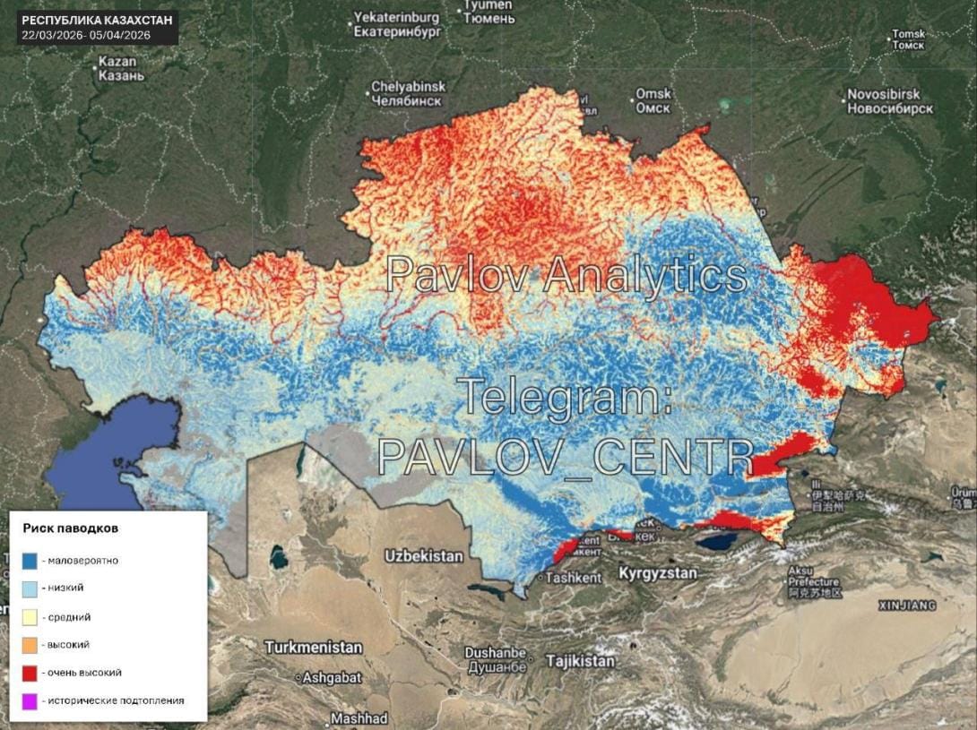
On the eve of the peak spring flood, the Pavlov Analytical Center, in partnership with Geobox and Giscarta, has introduced an innovative tool for monitoring water threats. The interactive map allows real-time assessment of flooding risks, which is critically important for planning spring field work and protecting rural settlements.
In a Nutshell
- An interactive forecasting tool has been launched, allowing the threat level to be detailed for each specific river section.
- Several regions of Kazakhstan are in a high-risk zone.
Color coding simplifies situation assessment, where red signals danger and yellow indicates the need for increased attention.
Monitoring Technologies and Risk Assessment
The interactive solution, developed by experts from Geobox and Giscarta for the Pavlov Analytical Center, combines data from satellite imagery, historical observations, and other systems. Users can zoom the map down to the level of individual districts and click on specific waterways to obtain the current risk category.
Risk visualization is based on an intuitive color scheme. A gray-blue color corresponds to the normal state of water bodies. Yellow indicates zones requiring increased attention due to possible changes in flow dynamics. Orange and red signal a high probability of problems and a direct danger of flooding, respectively. The intensity of the color is directly proportional to the degree of threat.


Comments ()